
Northern Idaho - 2005

In the summer of 2005, 7 of us did a week long bike tour of northern Idaho. We we're fortunate to have Kevin and Barbara along with their van as a support vehicle.

Start Date
Number of Days
9
Total miles
372

Planning the route

Many a beer was consumed while we studied maps and websites. Actually Andy did all the work. The rest of us just had to show up and ride. 

Ready to roll

At Kevin and Barbara's house ready to leave. We took two vehicles, their van, and Andy's car. Left-to-right: Paul, Dan, Paul, Kevin, Barbara, Larry. Andy took the picture. In fact Andy took most of these pictures so you won't see much of him. 

Image
Ready to roll
Mileage
372

Rides

Route Date Miles Bike Buddies Notes
Clark Fork - Thompson Falls (Ridaho) 61 Giant OCR2 Ridaho gang

No more rain. We said goodbye to Lake Pend Orielle and followed the Clark Fork River on into Montana. Montana is spectacular. Highway was not bad. Then back roads throgh some very nice ranches.


Thompson Pass - Dobson Pass - Wallace (Ridaho) 58 Giant OCR2 Ridaho gang

We got a late start after Barbara's dog wandered off. We had fun searching all over the campground and eventually the dog showed up.

Then if was off to Thompson Pass. A forever climb at maybe 7 or 8 percent through the Bitterroot Mountains. Spectacular mountain views.

Then down to the historic town of Murray with its old log cabin post office.

The second pass of the day was Dobson Pass. This was a real killer. Much steeper than Thompson Pass. We were delirious. When we got to the top Larry said "what a terrible climb", to which I said "what a great climb!".

And then it was down to the start in Wallace and our loop was complete.

Trail of the Hiawatha (Ridaho) 20 Rock Hopper Ridaho gang

Bonus day. We rented mountain bikes to ride the rail trail through tunnels and over tressels. A hot day with lots of people.

Trail of the Coeur d'Alenes (Ridaho) 61 Giant OCR2 Ridaho gang

Wallace Idaho

Wallace's big claim to fame is that they had the last working bordello in the US which is now the Oasis Bordello Museum. Our camp site was in a cold canyon that never got any sun.

Trail of the Coeur d'Alenes

One of the premiere paved rail-to-trails, the trail is straight and practically flat for 73 miles through the Silver Valley. The trail was built as a super-fund site. There was so much toxic junk that leaked or dribbled from the trains that they just buried it and paved over it. What we didn't know at the time was that what looked to be pristine meadows and woods just off the trail, was still quite contaminated.

Leaving Wallace we first went through a few old mining towns like Kellogg and Pinehurst, before heading out to some beautiful country.

Eventually we made our way across Chatcolet bridge before finding our campsite on the banks of Lake Coeur d'Alene

More about the Trail of the Coeur d'Alenes

Chatcolet - Coeur d'Alene - Farragut park (Ridaho) 82 Giant OCR2 Ridaho gang

A mix of busy roads, empty roads, gravel roads, bike paths, city streets, and country roads.

We started out on a nice road along the lake but soon did some serious climbing away from the lake. Andy was a little sketchy on the route at this point and we did have to ride a short gravel section. Paul had to ride on some super skinny lightweight tires I got for him. Larry was the only one with wide enough tires for gravel. Eventually the road came back down to the lake and we got on another paved bike path the rest of the way into Coeur d'Alene.

We left Coeur d'Alene and headed north. We knew this would be the longest day of the trip and we had already come a good distance. We climbed up to an open plateau of mostly grassland with views to the east. We got pretty spread out and I was well ahead when the road turned to gravel (or maybe just funky pavement, I can't remember). I waited for us all to regroup with the van, to figure out which way to go. The road was funky for a while but soon improved. Eventually we got on the main highway leading into the park.

Farragut Park

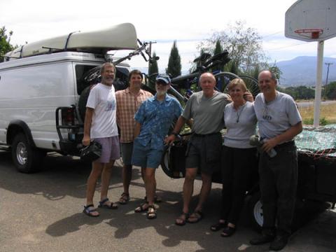
Farragut State Park is located near the very bottom, southwest corner of Lake Pend Oreille (pronounced 'pond array'), and is a popular destination. We had a reserved camp site and after a really long ride we were ready to relax, but when we got there we found our camp site was not quite what we hoped for. There was barely room to park the van, never mind a bunch of tents. Larry broke out the beer while Kevin and Andy went to see about finding better accommodations. They returned a while later with good news. They were sending us to a group campground that would have enough room. Enough room was an understatement. We had this whole place to ourselves for two nights. Now we were very happy.

.

Bayview - Athol - Farragut (Ridaho) 34 Giant OCR2 Andy, Paul

A day loop. Back country ranches, cabins, even a dome, and then a busy highway.

Farragut - Sandpoint - Clark Fork (Ridaho) 56 Giant OCR2 Ridaho gang

Rain, rain, rain, but nice green country. Incredible wetlands along Pend Orielle lake and Cark Fork river.

We had a few miles on a busy highway before a really nice bike path and bridge into Sandpoint. By then it was raining pretty steady so we stopped for second breakfast in Sandpoint. We even ran into some people we know from SOU. What are the odds of that?

After Sandpoint the road wraps around the top of Lake Pend Orielle and along the eastern shore. It was here that Kevin had a series of flats. I also had to pee alot after drinking a lot of tea in Sandpoint. So we stopped a lot and had time to read the interpretive signs along the lake shore.

We eventually go to our destination which was a nice resort in the town of Clark Fork, which is where the Clark Fork River hits Lake Pend Orielle. Although we had to pitch our tents on some pretty wet ground, the rain let up and they had a laundry we used to dry our stuff.